On 6th June 1944, the greatest seaborne invasion in history began Operation Overlord, a campaign which saw Allied forces fighting through France for nearly two months before reaching Germany itself to bring a close to World War II.
Better-known as the D-Day landings, the main aim was to weaken the Nazis' position, and give the Allies a bridgehead in Northern Europe.
The Normandy coast was split into five approach sites – given codenames Gold, Juno, Omaha, Sword, and Utah – the largest being Omaha Beach.
1. Rehearsals
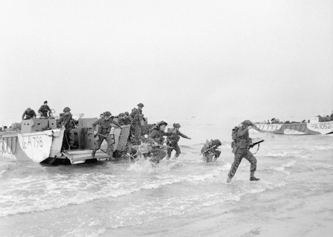
Image Credit: IWM
A lot of planning went into the assaults. Landing rehearsals were carried out in the UK as Exercises Tiger and Fabius, and troops attended detailed briefings about their respective section objectives.
Those destined for Omaha were needed to establish a beachhead 8km deep; secure the villages of Vierville, Saint-Laurent, and Colleville; then proceed up the road between Bayeux and Isigny-sur-Mer to support attacks at Trévières and Pointe du Hoc.
2. Prayers
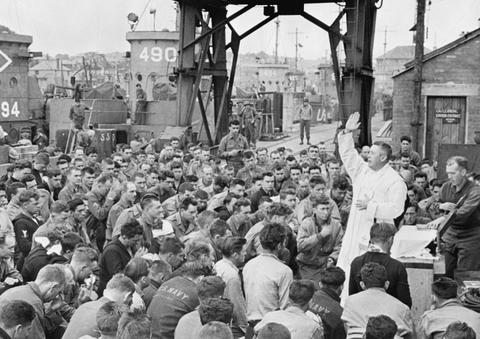
Image Credit: IWM
Father Edward J Waters, a US Army Major, conducted a Catholic service at the Weymouth quayside for those departing for Omaha. When the Allies landed in France, they faced seemingly-insurmountable odds.
Strong winds pushed the Higgins boats off-course and high tides swamped 10 vessels before reaching the shoreline. Other amphibious vehicles were saved solely by soldiers bailing water out using their hats. Preliminary bombings hadn't sufficiently damaged beach defences either, so troops faced heavy enemy fire.
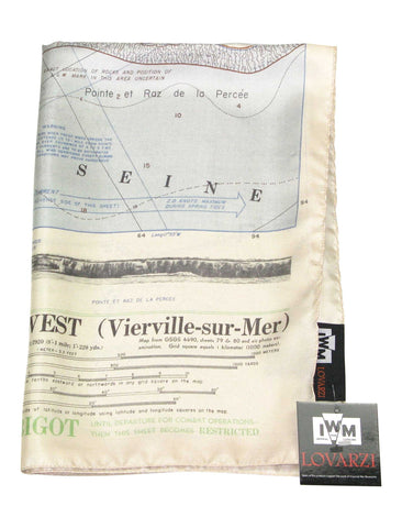
3. Omaha Beach Map
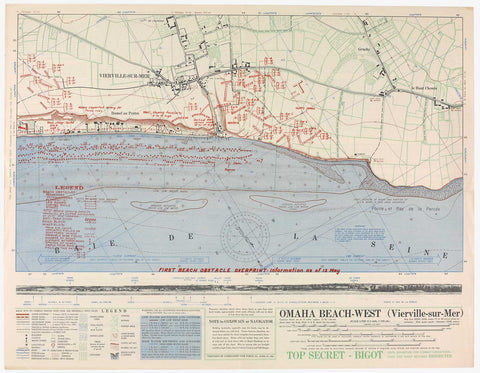
Image Credit: IWM
Deception tactics diverted German troops to Norway and Pas de Calais, away from the Allies' true targets. Production of resources was stepped up. And maps were issued to high-ranking officials to coordinate naval, air, and ground operations.
While a bird's-eye view of the coast occupies the lion's share of the document, the map also shows an illustration of the landscape at eye-level, including the intimidating 30ft cliff looming over the shore. Annotations note obstacles like minefields, sandbars, and the 10ft high seawall across the western part of the coast, as reported by air cover support.
4. Into the Jaws of Death
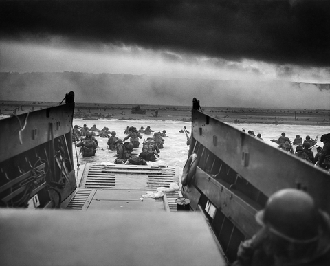
Image Credit: wikimedia.org
Into the Jaws of Death is perhaps the most famous photo from the D-Day landings. It shows the US Army 1st Infantry Division leaving the comparative safety of the Higgins boat for the Easy Red portion of the harbour.
Allied troops failed to accomplish any of their objectives on 6th June 1944, the first day of Operation Overlord. Many put their survival down to luck, finding shelter among the shingle and securing two strong footholds. The assaults gradually proceeded, helped along by tanks picking at the defences, and inspired by intuitive and courageous commanders.
5. Pointe du Hoc
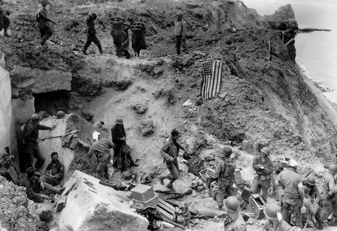
Image Credit: wikimedia.org
Relief crews took over from Rangers at Pointe du Hoc after the initial invasion, transporting German prisoners and spreading the American flag to stop friendly fire.
The elevated outcrop had been defended by the German 352nd Infantry Division using long-range guns. Air support had warned of concrete casemates; covered shelters; trenches; and barbed wire surroundings.
Bombers attacked this vantage point, resulting in a large displacement of rock and clay which the Allies used to scale the facade, aided by ladders and rocket-fired grappling hooks. German troops had removed some large weaponry from the casemates to escape the bombardment.
6. Statue les Braves
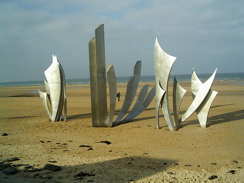
Image Credit: wikimedia.org
D-Day was ultimately a success, and marked the beginning of the end of the Second World War. But the cost was high.
The Normandy American Cemetery and Memorial at Colleville-sur-Mer pays tribute to the 9,387 soldiers whose names are inscribed on the field of crosses, and the 1,557 individuals on the Walls of the Missing. Museums rose up at Pointe du Hoc and Saint-Laurent-sur-Mer.
At Omaha's heart stands the Statue les Braves, a steely winged monument extolling hope, freedom, and fraternity.
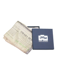
To mark the 75th anniversary of the D-Day landings, we have partnered with the Imperial War Museum (IWM) to create a special edition Omaha Beach Map scarf showing a map used by a British naval officer in 1944. Omaha Beach Map Scarf captures the details of the original map, including its legend, scale, and annotations, printed on 100% silk.
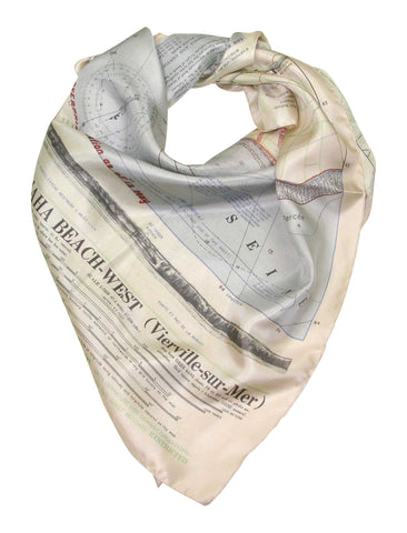
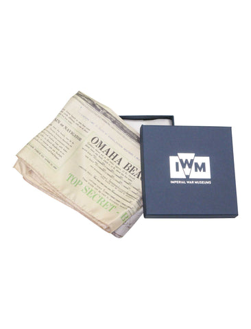
Sales of this product support the work of the Imperial War Museum.
Click here to buy Official Imperial War Museums Omaha Beach Map scarf